Forest Disturbance
Forest disturbance algorithm description
This section briefly illustrates the algorithms for the generation of BIOMASS products and implemented in BioPAL. For further information refer to the original source doi.org/10.3390/rs12060985. For specific topics see Publications.
The following table reports current target figures for the products.
| Level 2 Product | Resolution | Accuracy |
|---|---|---|
| AGB | 200 m | <20% (or 10 t/ha for AGB<50 t/ha) |
| FH | 200 m | <30% for trees higher than 10 m |
| FD | 50 m | detection at a specified level of significance |
The products are intended to be global, covering forested land areas between 75°N and 56°S but subject to United States Department of Defense Space Object Tracking Radar (SOTR) restrictions, as illustrated.
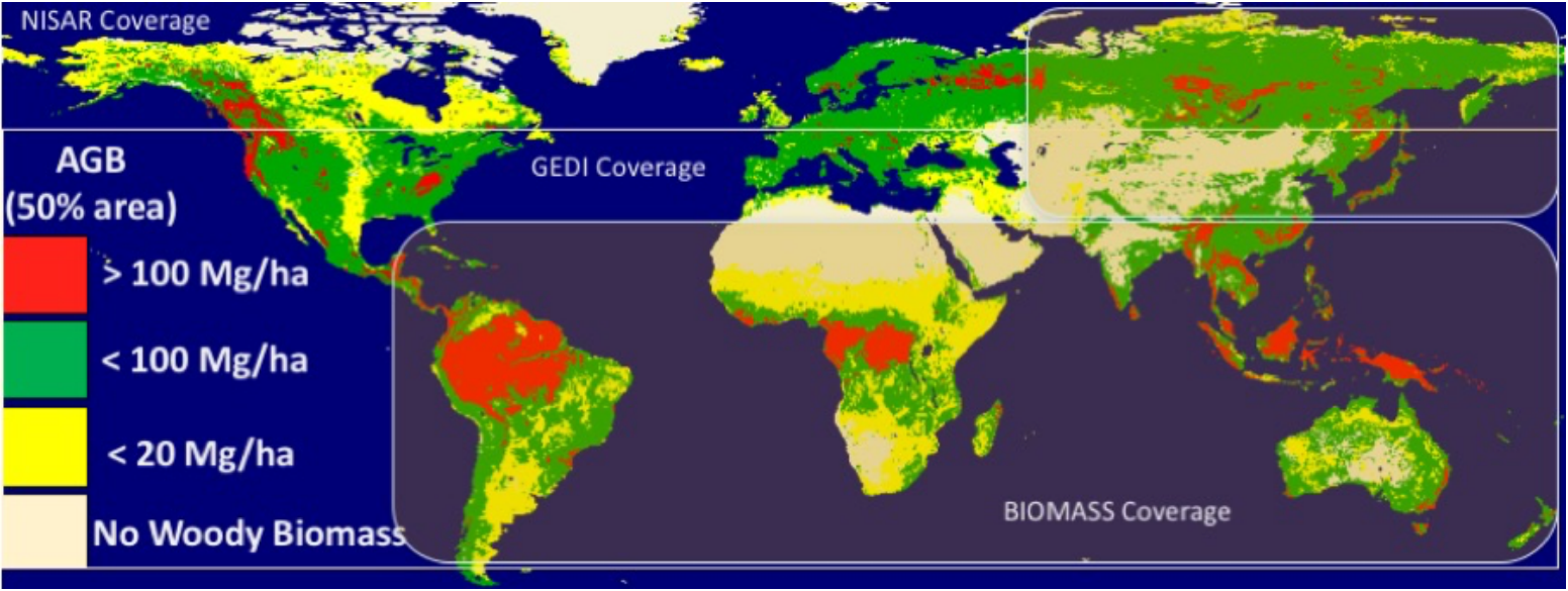 Map of coverage of ESA and NASA satellite measurements of forest structure and biomass. The background shows the global coverage area of the NISAR mission and the sensitivity of NISAR to aboveground biomass values < 100 Mg/ha (green and yellow). The BIOMASS mission coverage includes the tropical belt and a portion of the northeast Siberia and the GEDI LiDAR sampling coverage from the International Space Station (ISS) between ±50 degrees latitude. Original source Forest Observation System.
Forest disturbance algorithm description
Forest Height estimation
Above Ground Biomass estimation